
Remote Sensing Technology(Remote Sens. Technol.)_遥感技术
Time:2026-06-02 Visits:1
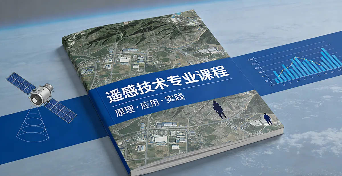
Remote Sensing Technology Major
Remote sensing technology Major serves as the core foundation for Earth observation and spatial information in the 21st century. By 2026, with the deep integration of AI, big data, cloud computing, and other technologies, it is undergoing a profound transformation from “data acquisition” to “intelligent services.”
Introduction to Remote Sensing Technology Major
Remote sensing technology Major is an interdisciplinary field that studies the acquisition, processing, analysis, interpretation, and application of multidimensional spatiotemporal information about Earth and other celestial bodies through integrated airborne, terrestrial, and space-based sensing platforms. It fuses physics (principles of electromagnetic radiation), engineering (sensor design), computer science (digital image processing and AI), and earth sciences (geo-interpretation), serving as the hardcore discipline that performs “CT scans” on our planet.
If human understanding of Earth is likened to a pair of eyes, remote sensing technology is the magical power that breaks through visible light limitations, enabling “千里眼” (clairvoyance) and “显微镜” (microscope) capabilities—satellites detect every forest fire from hundreds of kilometers above, radar penetrates clouds to map floods, and hyperspectral sensors identify mineral compositions using spectral fingerprints. The core mission of this discipline is “to safeguard our green mountains and clear waters with spatial big data, and to warn of geological hazards with intelligent algorithms.”
Professional Characteristics from an International Perspective: Remote sensing is a highly internationalized, multidisciplinary field. Western countries lead in sensor development, radar technology, and algorithm creation (e.g., Stanford University's collaboration with NASA/ESA); China is rapidly advancing in satellite constellation deployment and application system development (e.g., the “Mineral University Nanhu” satellite);
International organizations (such as the United Nations and World Bank) have strong demand for remote sensing technology to address global challenges like climate change and food security. This is a frontier technology-driven discipline closely aligned with national strategies and offering broad global career prospects.

Core Courses at International Institutions
Top international universities emphasize “theory-practice integration and technology-application balance” in remote sensing curricula, typically adopting a modular structure of “core fundamentals + specialized tracks + comprehensive practice.”
Core Fundamentals Module (e.g., University of Liège and KIT):
- Mathematical and Physical Foundations: Advanced Mathematics, Linear Algebra, Statistics, Physics (Optics, Electromagnetic Radiation Theory), Signal Processing
- Remote Sensing Principles: Introduction to Remote Sensing, Optical Remote Sensing, Thermal Infrared Remote Sensing, Passive and Active Microwave Remote Sensing (Radar), Hyperspectral Imaging, Lidar
Specialized Remote Sensing Technology Modules:
| Specialization | Representative Courses | University Examples |
| Optical Remote Sensing | Principles of Optical Remote Sensing, Vegetation Index Time Series Analysis, Radiative Transfer Models | University of Liège |
| Microwave Remote Sensing | SAR and InSAR, Radar Data Processing, Interferometry Techniques | Stanford University, KIT |
| Hyperspectral Remote Sensing | Hyperspectral Imaging, Spectral Demixing, Land Cover Classification | University of Liège, KIT |
| Computer Vision | Computer Vision Fundamentals, Image Processing, Pattern Recognition | KIT |
| Geoinformatics | Spatial Databases, WebGIS, 3D/4D GIS, Spatio-Temporal Data Analysis | KIT, University of Liège |
| Environmental Monitoring | Ecosystem Monitoring, Flood Mapping, Wildfire Detection, Glacier Change | University of Liège, Stanford University |
Specialized Frontier Modules:
- Google Earth Engine Cloud Platform: Cloud Computing and Analysis of Massive Remote Sensing Data
- Python Remote Sensing Development: Open-Source Tools like Rasterio, GeoPandas, GDAL
- AI and Deep Learning: Remote Sensing Image Classification, Change Detection, Object Recognition
- Digital Twins: Spatio-Temporal Big Data and Smart Twins
- Planetary Remote Sensing: Mercury ice layer detection, Titan surface analysis
Integrated Practice Modules:
- Lab Rotations: Month-long research practice at institutes (KIT signature, 20 credits)
- Capstone Project: Team-based project integrating theory and technology to solve real-world problems
- Industry Internships: Practical collaboration with aerospace agencies and remote sensing enterprises
- Master's Thesis: Six-month independent research, completed on or off campus
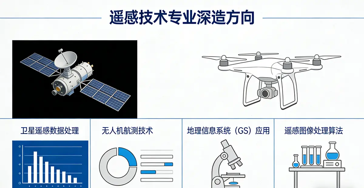
Advanced Study Pathways in Remote Sensing Technology Major
Master's and doctoral research focuses on highly specialized and cutting-edge areas, primarily covering:
Data Acquisition and Processing:
- Novel Sensor Technologies: Hyperspectral imaging, LiDAR, microsatellite constellations
- Signal Processing and Algorithms: Interferometric phase unwrapping, atmospheric correction, multi-source data fusion
- High-Performance Computing: Parallel processing, cloud computing platforms, big data architectures
Intelligent Interpretation:
- AI and Deep Learning: Remote sensing image classification, object detection, semantic segmentation, change detection
- Computer Vision: 3D reconstruction, stereo vision, feature extraction
- Natural Language Processing: Automated remote sensing report generation, knowledge graphs
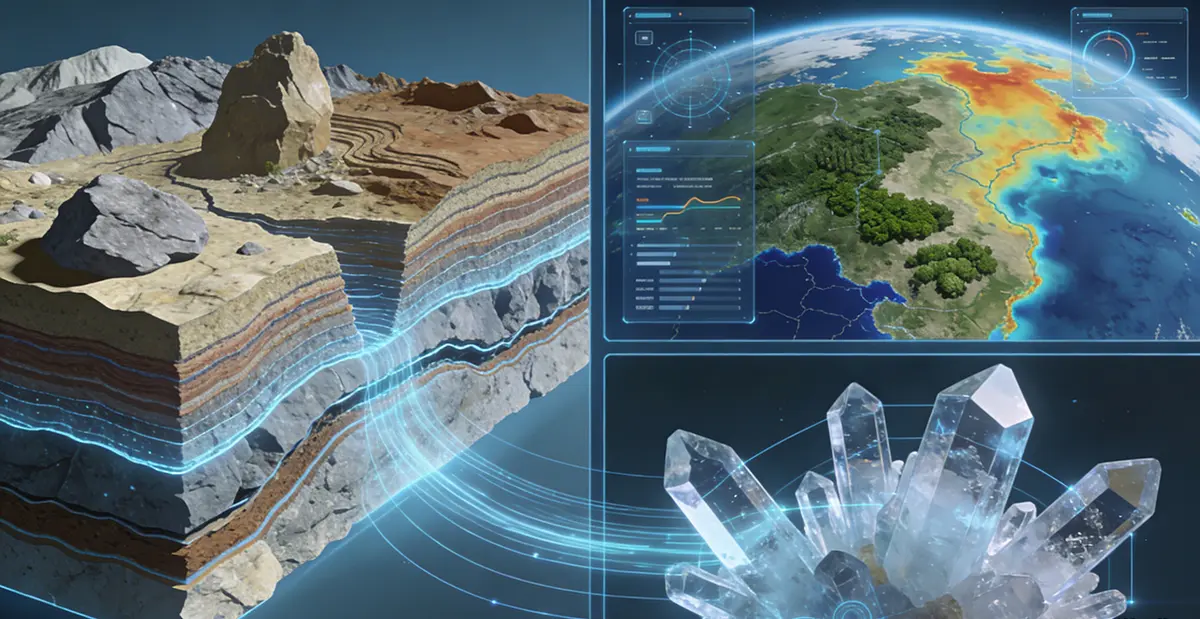
Quantitative Remote Sensing:
- Radiative Transfer Modeling: Vegetation, soil, and water body parameter inversion
- Ecological parameter estimation: Leaf area index, biomass, primary productivity
- Surface parameter inversion: Surface temperature, emissivity, soil moisture
Specialized Application Directions in Remote Sensing Technology Major:
| Application Domain | Research Direction | Example Institutions |
| Disaster Monitoring | Seismic deformation (InSAR), volcanic activity, flood inundation, wildfire detection | Stanford University, University of Liège |
| Resource & Environment | Mining area ecology, soil erosion, wetland changes, forest monitoring | Xi'an University of Science and Technology, University of Liège |
| Climate Change | Polar ice sheet changes, glacier melt, sea level rise | Stanford University |
| Agricultural Remote Sensing | Crop Growth Monitoring, Yield Estimation, Agricultural Insurance | Solafune |
| Urban Remote Sensing | Urban Expansion, Impervious Surface Extraction, Heat Island Effect | China University of Mining and Technology |
| Planetary Science | Martian Topography, Mercury Polar Ice, Titan Methane Lakes | Stanford University |
International Career Paths and Positions
Graduates in remote sensing technology are in high demand globally, with employment spanning the entire spectrum of government agencies, corporations, international organizations, and research institutions.
Core Employment Sectors:
| Sector | Typical Employers | Representative Positions |
| Space/Remote Sensing Agencies | NASA, ESA, DLR, JAXA, National Satellite Meteorological Center | Remote Sensing Scientist, Algorithm Engineer, Mission Designer |
| Technology Companies | Google, Microsoft, Amazon, Solafune | Geospatial Data Scientist, Remote Sensing Algorithm Engineer, AI Researcher |
| Geospatial Firms | Esri, Hexagon, Airbus Defence and Space | GIS Specialist, Remote Sensing Analyst, Software Engineer |
| International Organizations | United Nations (FAO, WFP, UNDP), World Bank | Remote Sensing Specialist, Program Officer, Humanitarian Assistance Advisor |
| Government/Public Sector | National Geological Surveys, Environmental Protection Agencies, Forestry Departments | Remote Sensing Monitor, Resource Survey Engineer |
| Consulting/Engineering Firms | AECOM, Jacobs, Tetra Tech | Environmental Remote Sensing Consultant, GIS Project Manager |
| Startups | EO/GeoAI Startups | Technical Partner, Data Scientist |
| Research & Education | Universities, Research Institutes | Researcher, Postdoctoral Fellow, Lecturer |
Representative Global Positions (Based on Latest Job Postings):
1. Geospatial Data Scientist (Solafune, Tokyo): Develop satellite-based R&D projects, design data processing pipelines, build models for change detection, classification, and prediction. Requires PhD + 2-5 years Python experience, familiarity with Rasterio/GeoPandas/PyTorch
2. Remote Sensing Data Engineer (European Space Company): Process optical, radar, and hyperspectral data; develop automated workflows; support environmental monitoring projects
3. EO Data Scientist (Vito Remote Sensing, etc.): Apply AI to analyze Earth observation data; deliver solutions for agriculture, forestry, and urban development
4. Remote Sensing Analyst (FAO/UN Food and Agriculture Organization): Monitor global food security, land use change, and disaster impacts using remote sensing
5. InSAR Engineer (Geological Survey/Consulting Firm): Processes interferometric radar data to monitor seismic deformation, ground subsidence, landslides, and other geological hazards
6. Algorithm Engineer (Tech Company): Develops AI algorithms for remote sensing image classification, target recognition, and change detection, deploying them on cloud platforms
7. Forest Remote Sensing Specialist (World Food Programme): Utilizes remote sensing to monitor forest resources and support humanitarian operations
Salary Levels (International Reference):
- United States: Median annual salary for remote sensing scientists/engineers approx. $85,000–120,000; senior specialists may reach $140,000+
- Europe: Entry-level remote sensing positions in Germany approx. €50,000–65,000; international organization roles offer more competitive compensation
- Japan: Solafune positions require PhD + experience; salary is negotiable but competitive
- International Organizations: UN system roles offer generous after-tax benefits but have higher requirements
Global Employment Rates and Industry Trends
Employment Rates and Talent Shortages:
- Approximately 20,000–25,000 job openings exist globally in the geospatial sector, projected to double within the next five years
- Among 67 graduates of the Copernicus Digital Earth Master's program, 19 advanced to doctoral studies (at top institutions in Germany, the U.S., France, Norway, Australia, etc.), while 48 entered industry employment
- The U.S. market recently experienced volatility due to economic policies; federal layoffs led to a surge in resumes and intensified competition
Industry Development Trends:
1. Deep Integration of AI and Remote Sensing: Approximately 45% of organizations have begun adopting AI and deep learning technologies. Deep learning significantly outperforms traditional methods in remote sensing image classification, object detection, and change detection. Job requirements commonly include skills in TensorFlow/PyTorch and computer vision.
2. Cloud Computing and Big Data Platforms: Cloud platforms like Google Earth Engine, AWS, and Azure enable processing of petabyte-scale remote sensing data. Experience in designing data processing pipelines and cloud architecture has become a significant advantage.
3. Explosion of New Data Sources: Hyperspectral imaging, LiDAR, and microsatellite constellations (e.g., Planet) provide data with higher spatio-temporal resolution. UAV remote sensing has become widespread for localized monitoring. Demand for data processing and fusion capabilities has surged.
4. Commercial Application Expansion: Remote sensing transitions from research to business applications—agricultural insurance, disaster assessment, urban management, carbon trading monitoring, illegal mining detection, etc. Platforms like Solafune solve real-world business problems through competitions.
5. Open-Source Tools Dominate: Python ecosystems (Rasterio, GeoPandas, GDAL) and QGIS gain widespread adoption, lowering technical barriers.
6. Polarization in the job market: Entry-level positions face intense competition due to AI screening and resume overload; yet advanced technical roles (programming + AI + remote sensing + domain expertise) remain in short supply. Candidates with interdisciplinary backgrounds and project experience are increasingly sought after.
7. Evolving Skill Requirements: Pure remote sensing knowledge is insufficient; comprehensive competencies in programming (Python/R), AI/ML, cloud platforms, databases, and engineering practice are now essential.
Ideal Candidates for Remote Sensing Technology Major
You'll gain a competitive edge internationally if you possess these traits:
1. Strong Math and Physics Foundation: Solid grounding in mathematics (linear algebra, calculus, probability/statistics), physics (electromagnetic radiation, optics), and signal processing.
2. Strong programming skills: Python is the industry standard, with R and MATLAB also widely used. You must be able to write data processing pipelines and implement algorithmic models.
3. Interdisciplinary mindset: You can seamlessly switch between physical principles, algorithm development, and geoscience applications to solve real-world problems with technology.
4. Curiosity about Earth systems: You care about climate change, ecosystems, and natural resources, and want to contribute to sustainable development through technology.
5. Hands-on and practical skills: Enjoy working with real data, debugging code, optimizing algorithms, and conducting field verification.
6. Continuous learning mindset: Rapid technological evolution (new sensors, algorithms, platforms) demands ongoing knowledge updates.
7. Fluent English: Remote sensing is a highly international field where literature, conferences, and collaborations primarily use English.
Core Competencies of the Remote Sensing Technology Major
The core competitiveness of this major lies in its end-to-end technical capabilities spanning the entire chain from “raw signals” to “decision-making information”:
Multi-source remote sensing data processing: Proficient in handling diverse data types including optical, radar, hyperspectral, and lidar imagery, mastering preprocessing techniques such as radiometric calibration, geometric correction, atmospheric correction, and noise reduction.
Algorithm Development and AI Application Capabilities: Design and implement algorithms for image classification, object detection, and change detection, proficiently applying deep learning frameworks (PyTorch/TensorFlow) to solve remote sensing challenges.
Geospatial Analysis Capabilities: Proficient in GIS tools and spatial analysis methods, capable of integrating remote sensing results with vector and attribute data for spatial statistics and modeling.
Cloud Computing and Big Data Engineering Capabilities: Capable of designing data processing pipelines to handle large-scale remote sensing data on cloud platforms such as Google Earth Engine, AWS, and Azure.
Quantitative Inversion & Physical Modeling: Understands radiative transfer processes and constructs physical models to invert surface parameters (e.g., leaf area index, soil moisture, biomass).
Domain Knowledge & Cross-Application: Comprehends scientific challenges in specific sectors (agriculture, forestry, geology, hydrology, urban studies) and translates remote sensing technologies into domain-specific solutions.
Engineering and Productization Mindset: Translate research algorithms into production-grade systems while prioritizing code maintainability, system scalability, and user experience.
Major Institutions Offering Programs
(Selected Institutions Listed - No Ranking Implied)
1. China
The Hong Kong Polytechnic University, The University of Hong Kong, Wuhan University, Xidian University, China University of Geosciences (Wuhan), Northwestern Polytechnical University, University of Electronic Science and Technology of China, Sun Yat-sen University, Beijing Normal University, Peking University, Tongji University, Beijing Institute of Technology, Tsinghua University, Nanjing University of Information Science and Technology, Zhejiang University, Hunan University, Beihang University, Harbin Institute of Technology, China University of Mining and Technology, Chongqing University, East China Normal University, Ocean University of China, Shandong University of Science and Technology, Xiamen University, Nanjing University, Fudan University, Shenzhen University, etc.
2. Spain
University of Extremadura
3. United States
Mississippi State University, University of Maryland, College Park, California Institute of Technology, Boston University, Michigan State University, University of Illinois at Urbana-Champaign
4. Canada
University of Waterloo, University of British Columbia
5. France
University of Grenoble Alpes
6. Germany
Technical University of Munich
7. Netherlands
Delft University of Technology, Wageningen University
8. Singapore
Nanyang Technological University, National University of Singapore
9. France
Université Paris-Saclay
10. United Kingdom
University of Cambridge
11. Leading International Research Teams (No dedicated departments but outstanding research):
- Stanford University: Global leader in radar remote sensing research. Joint efforts between Electrical Engineering and Geophysics departments focus on InSAR technology, planetary radar, and signal processing.
- KIT (Karlsruhe Institute of Technology): Offers a Master's in “Remote Sensing and Geoinformatics” with 6 specialization tracks, emphasizing Lab Rotations for hands-on research practice.
Recommended Learning Path for Remote Sensing Technology Major
1. Build a Solid Foundation (Undergraduate Level): Focus on mathematics, physics, and programming. Master advanced mathematics, linear algebra, probability and statistics, and university physics (especially electromagnetism and optics), as these form the cornerstone for understanding remote sensing principles. Simultaneously, become proficient in Python programming and familiarize yourself with foundational libraries like NumPy, Pandas, and Matplotlib. Recommended to learn GIS fundamentals (ArcGIS/QGIS).
2. Build Professional Framework (Mid-to-Late Undergraduate): Deepen knowledge in core courses like Remote Sensing Principles, Digital Image Processing, and Remote Sensing Applications. Select a specialization based on interests (optics, radar, hyperspectral, etc.). Begin exploring open-source remote sensing libraries (Rasterio, GDAL, GeoPandas) and Google Earth Engine. Aim to participate in faculty research projects or competitions such as remote sensing image processing competitions).
3. Focus and Deepen (Master's Stage): Select a research direction based on interests, such as AI-driven remote sensing, quantitative remote sensing, or InSAR. Actively seek industry internships, particularly at remote sensing companies, aerospace institutions, or tech firms. For master's theses, prioritize topics closely aligned with industry needs or cutting-edge research. Note application deadlines for international programs like KIT (typically June/November).
4. Future Planning and Internationalization (Throughout):
- Language and Perspective: Obtain IELTS or TOEFL certification (KIT requires English B2). As a highly international field, fluent English is essential. Monitor top international journals (e.g., Remote Sensing of Environment) and conferences (IGARSS).
- Skill Map: Target industry needs to supplement skills:
- Programming: Advanced Python (object-oriented, engineering-focused), SQL/PostGIS, Git
- AI/ML: scikit-learn, PyTorch/TensorFlow, Computer Vision
- Cloud Platforms: AWS/Azure/GCP fundamentals, Docker
- Professional Software: ENVI, SNAP (ESA), PIE (domestic)
- Open-Source Contributions: Gain experience by participating in open-source projects (e.g., QGIS, GDAL) to demonstrate coding proficiency
- Networking: Build LinkedIn connections, join professional organizations (IEEE GRSS, EARSC), and stay updated on industry trends
- Expand International Experience: Pursue international exchanges, overseas lab research, or internships at international organizations. Copernicus program graduates intern globally.
5. Domestic Career Pathways (Using China University of Mining and Technology as an example):
- Graduates may pursue production, management, or research roles in natural resources, ecological environment, disaster response, and urban-rural planning sectors
- Opportunities exist in high-tech enterprises for R&D in remote sensing big data & AI, smart mining, and smart cities
- Further studies for master's or doctoral degrees at domestic/international universities or research institutions
- The Previous Passage:New Media Technology(New Media Technol.)_新媒体技术
- The Next Passage:Metallurgical Engineering(Metall. Eng.)_冶金工程
Human Geography Major_Geography(Geog.)_人文地理
The Human Geography Major explores the complex relationships between human activities and space, cul···

Atmospheric Sciences(Atmos. Sci.)_大气科学
Atmospheric science is the study of phenomena and evolutionary patterns within Earth's atmospher···
Earth Sciences(Earth Sci.)_地球科学
The Earth Science major focuses on studying the Earth system and its interactions, providing a scien···
Ocean Sciences(Ocean Sci.)_海洋科学
PbootCMS是全新内核且永久开源免费的PHP企业网站开发建设管理系统,是一套高效、简洁、 强悍的可免费商用的···